Pages

Year in Review

A la niña winter. A warm, rain-ridden spring followed by late season snow storms. A cool summer and a high alpine backpacking season frequently thwarted by the lingering snowpack. Snowshoeing. New solo hikes. Blisters. Yellowstone. Spain. Bike wrecks & getting chased by geese. Although recently I haven't been out as much as I would have liked (due to this little thing called SKOOL), t'was a good year.

This is mostly just a trail summary, with some of my favorite pictures from last year.

JANUARY
Tamanawas Falls snowshoe, Mt. Hood Wilderness: ~4.5 miles, ~500 ft elevation change.

frozen Tamanawas Falls

Boundary Trail, MSH National Monument: ~6 miles, ~1000 ft elevation change.
Coyote Wall, Columbia River Gorge: ~12 miles, ~1950 ft elevation change.
Eagle Creek, Columbia River Gorge: ~9 miles, ~600 ft elevation change.

FEBRUARY  
We spent February 13th-18th in Yellowstone National Park. It's one of the best trips I have ever taken.

MARCH
Hummocks/Boundary Trail snowshoe, MSH National Monument: ~5.5 miles, ~1200 ft elevation change.

Helens' winter coat


APRIL
Swale Canyon, Klickitat Trail, Washington: ~6.5 miles, ~200 ft elevation change.
Multnomah-Franklin Ridge Loop, Columbia River Gorge: ~12 miles, ~2650 ft elevation change.
Dog Mountain, Columbia River Gorge: ~7.5 miles, ~2820 ft elevation change.

MAY
Hamilton Mountain, Columbia River Gorge: ~8 miles, ~2100 ft elevation change.

Hamilton & the Gorge

Ruckle Creek Trail, Columbia River Gorge: ~7 miles, ~2660 ft elevation change.

JUNE
Swift Creek Trail, MSH National Monument: ~4.5 miles, ~1000 ft elevation change.

JULY
Burnt Lake Trail, Mt. Hood Wilderness: ~6.8 miles, ~1500 ft elevation change.
Grassy Knoll,Wind River Recreation Area: ~4.4 miles, ~1200 ft elevation change.
Mount Saint Helens Climb: 12 miles, 5600 ft elevation change.

Worm Flows climbing route

Little Baldy, Silver Star Scenic Area: ~8.4 miles, ~1600 ft elevation change. 
Ed's Trail, Silver Star Scenic Area: ~5.5 miles, ~1400 ft elevation change.

AUGUST
Cooper Spur, Mt. Hood Wilderness: ~8 miles, ~2800 ft elevation change. 
Goat Lake backpack, Goat Rocks Wilderness, Washington: 13 miles roundtrip, ~1770 ft elevation gain

moonrise over Ives Peak & Old Snowy
Wallace Falls State Park, Washington: 5.5 miles, 1200 ft elevation gain

SEPTEMBER
Santiam Pass-Canyon Creek Meadows-PCT Loop, Mt. Jefferson Wilderness: ~25 miles, no idea. 
Zig Zag Canyon Overlook, Mt. Hood: ~5 miles, no idea.
Paradise Park, Mt. Hood Wilderness: ~12.3 miles, 2300 ft elevation gain

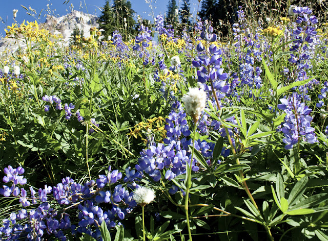
flowers galore in Paradise


OCTOBER
Ingalls Lake backpack, Alpine Lakes Wilderness: ~10 miles, 2500 ft elevation change


Butte Camp Trail, MSH National Monument: ~8.5 miles, ~1700 ft elevation gain

NOVEMBER
(Nothing but project, project, paper, paper, exam, exam.)

DECEMBER
Coyote Canyon Trail, Columbia River Gorge: ~6ish miles? elevation gain unknown
Larch Mountain Trail, Columbia River Gorge: ~8 miles, ~2800 feet elevation gain

~220.3 miles, ~40,400 feet elevation gain. 
Hide and Seek


COYOTE CANYON TRAIL
Columbia River Gorge National Scenic Area, Washington
~6ish miles?

The Coyote Wall is a relatively new trail complex on the Washington side of the gorge, just past Hood River. The giant basalt cliff lies in that fascinating transition zone between the stormy, damp western half of the gorge and its drier, golden-hued, eastern counterpart. From I-84, the Coyote Wall looks to plunge on a long, angled slide into the Columbia River; it never fails to grab my attention on any drive through the gorge. Until recently, the area was private range property which is now quickly turning into a mountain biking mecca. 

the cattle chute

Hikers are welcome here, but make no mistake, the trail complex here was built for and is maintained by cyclists. Watch uphill and be polite- hikers are the guests here.

That said, cycling trails completely screw with any hiker sense of direction I might have. Rocky and I set off mid-morning to attempt the Coyote Wall (short) loop in reverse, heading up the Coyote Canyon trail, the wall still visible from the lower part of the trail but disappearing into thick fog higher up. My dog took off, a joyous, bounding, deer-colored streak zooming along S-curves and soft dirt built for mountain biking whoop-de-whoops which made no sense to my hiker legs. Still, it was a gorgeous, winter hike through bare-branched oak forest, the meadows littered with umber colored leaves, silver-green moss clinging to any surface allowing it to thrive. 

a little mountain biker boulder garden

This was my third visit to the Coyote Wall complex, and it is officially one of my beloved winter/early season hikes. A good friend and I first visited in April 2010: we were greeted by an explosion of balsam root and lupine flowers, and we also got very lost, accidently ending up on private property while attempting to navigate the complex of trails and roads still left over in the area. Since we didn't have any wine or cheese, back the way we came.

Bring wine & cheese next time
 
My second visit consisted of myself, Andy and two dear friends attempting to complete the Coyote Wall (long) loop in typical January conditions.  We traipsed along the narrow, narrow, narrow Crybaby Trail, the cliffs spooky and beautiful in dense fog. During this trip I noticed the Wizard Trail junction plunging down the wall and filed it away in my mental hiking rolodex for future reference. We made it down a private road to what we *thought* was our trail junction but ended up far north and west of the wall when we finally popped out of the woods. Whoopsies. From there, it was cross-country and down and to an angle to find our way back to the trailhead. 

Not for crybabies
I'm not sure why I chose to begin the loop clockwise instead of counterclockwise in terrain I already knew. Probably had something to do with Rocky bounding off like a crack head just past the cattle gate. Decision made. Regardless, as I progressed higher up the trail into thick, dense fog, I couldn't help but admire the trail from a two-wheel point of view. Make no mistake, I am NO mountain biker- I'm more likely to run headfirst into a tree than make it downhill intact. Still, if I were more talented, I might consider it: this single track looked like a helluva lot of fun.
 
Approximately two miles from the cattle gate, I found the nearly invisible-to-spot junction with the Wizard Trail. I turned right and soon stumbled across a second junction I had not read about. Hmmmm. One fork was marked with blue flagging but looked less used, the other fork was more distinct, but unflagged.  

Just to completely screw with any iron I might have in my nose, the entire forest was shrouded in one of the densest layers of fog I have ever hiked in. I knew the Coyote Wall was looming almost directly in front of me and that I needed to be climbing up it, but I couldn't see it. There was absolutely no sense of direction. I wandered around both forks for a while before eventually deciding to head up the left (unflagged) fork. Here it was clear the trail sees little to no use, no evidence of hiking boots or bike wheels marred the thick layer of oak leaves. And again, biking trails make no sense for hiking legs- the little loop-de-loops and whoop-de-whoops make the trail feel like it is consistently going the wrong direction. 


Poor planning on my part. Oh well. With no map and no printed trail directions with me, I chose instead  to just wander through the glorious, fog-shrouded woods for a while. Eventually I happened upon a section of trail that looked like I might actually be on the right path, and proceeded to almost immediately lose the trail in wet meadow and fog. Hmmmm. I perched atop a rock for a while, watching mist play between tree branches, and surprised myself by feeling very much a child again. My agenda for the day had failed, but I had found an unexpected and coveted space of emotion: I felt secretive, hidden, lost in the woods, queen of my own domain. There was no one else around. 


Eventually I returned the way I came, and upon further analysis at home, determined I was most likely on the right track up the Coyote Wall. I was headed in a northwest direction, navigating the base of the wall (or where I *think* it was), and I passed a few signature, downed trees written about in the trail description. My expectations of what the trail should look like from a hiker point of view confused my sense of direction, but when I think about it, the trail would wander (seemingly aimless) as it slowly climbed higher along the wall. After all, what is fun for cyclists and what makes sense for hikers are two very different things.

Still, it's a brilliant area. And one that always plays hide and seek with my sense of self.

Larch Mountain Fail


Question: When do paved, interpretive trails and gorgeous waterfalls NOT mix?

Answer: Anytime the weather turns below freezing for extended periods of time. All that glorious waterfall spray? Yup, turns the path into a skating rink.


LARCH MOUNTAIN TRAIL
Columbia River Gorge National Scenic Area, Oregon
~8 miles, ~2800 feet elevation gain

I had just crossed the Multnomah Falls bridge viewpoint when I was abruptly halted by a layer of solid ice, about an half inch thick. A nice gentleman just in front of me was carefully shuffling his way up the path, tossing a layer of gravel across the ice as he went. Rather than skidding out over the next 100 feet of trail, Rocky and I waited patiently behind him for the task to be complete.


My goal today was Larch Mountain, a long, forested , straight-shot hike to the top of gorge from Multnomah Falls. Being midweek and 32 degrees at the trailhead, it made sense that I was alone- still, it's very, very odd to be heading up the Multnomah Falls trail without a soul in sight.

I love the gorge in winter. There is a remarkably stark yet vibrant quality to the area- looming cliffs shrouded in fog, silhouetted trees in the forest, the details whittled down to green mosses, ferns, rock and water, all the chaos of summer foliage gone. I rarely visit the gorge in summer: too many tourists. But in winter? This is when, for me, the gorge comes to life. 


That said, trail maintenance is zero in the winter. Mud is expected, as are slick conditions and downed trees. Given the recently dry (but oh so cold) spell holding on to the greater Portland area, the trail was remarkably ice free in areas where I expected slick conditions, and an icy wonderland in sections I would not have expected. The tiny, frozen details were enchanting.

About four miles in, growling and annoyed, I stopped to take stock of myself. I was a little over halfway to Larch when I knew I had a problem. Although I had been hiking uphill for roughly two hours and should have been in full throttle, hiking swing, my core temperature was dropping rapidly. It felt like I was fighting every muscle in my body to continue up the trail; I was feeling ill and stiff, sweat-drenched and lethargic, and I was beyond shivering even. Not a good sign.

Grrrr.

I drank some warm tea, re-layered clothing, and finally gave up on eating as I just couldn't stomach it. In the end, I made the decision to turn around. Over the last couple of months, I have had a brilliant professor who has repeatedly encouraged us to notice what is in our bodies and to ask clients to do the same. Noticing the details of how you feel, where you are in space- mentally, emotionally, physically- are a vital component to delivering care. Today, in below freezing temperatures, four miles from the trailhead with three more to go, it was better to be safe and listen to what my body was telling me. 


I took my time going downhill. I stopped frequently, drank warm tea, evaluated Rocky's feet, and took in the details of the forest. Now that I wasn't racing daylight, I stopped to soak in the minutia that calls attention to itself when we stop rushing and just take the time to be. Although the day wasn't what I planned it to be, it was, nevertheless, not a loss. 

I love winter.