Pages

Paradise Redux


TIMBERLINE LODGE TO PARADISE PARK
Mount Hood Wilderness, Oregon
~12.3 miles, 2300 feet elevation gain

The first day of autumn. My favorite, fleeting season.

Ever since the Salewa blisters on Monday turned me around at the edge of the Zig Zag River, I have been thinking about Paradise Park.

On my first hike to Paradise, I was still in college and just beginning to enthusiastically embrace the outdoors. Total newbie hikers, but completely invincible (as twenty-ish year olds tend to be), a friend and I left warm and sunny skies on a July day in Portland only to find ourselves stepping out into 42° F temps at Timberline Lodge. The mountain was nowhere to be seen, shrouded in a thick layer of dark, roiling clouds. Each of us had a hat and fleece and were otherwise appropriately dressed in shorts and tank tops for a near freezing day on the mountain. 

Hello? Ten Essentials? What are those?

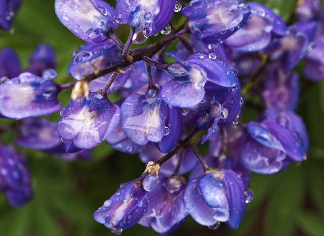
For some reason, we decided to go for it. We never saw the mountain. Always layered in fog and cloud, by the time we hit the high alpine meadows of Paradise, it was raining. Yet that day still stands as one of my fondest memories of my backyard mountain playground. The landscape surrounding us possessed a ghostly, intimate quality: we delighted in discovering tiny rock gardens ablaze with color; heather, lupine, indian paintbrush and countless other flowers lined our path; we were soaked through, our breath hanging in the air; the forest was all moss, dripping water and silvery fog; small creeks and seasonal waterfalls burbled and bubbled; and we arrived to find the meadows in full bloom.

The next time I hiked to Paradise, the meadows were at least three weeks away from flowering. Disappointed, Andy and I still enjoyed the high alpine terrain of the Paradise Loop Trail as it meandered its way just above timberline, Mount Hood gracing the skyline above us. I also received the worst sunburn of my life on this hike- I still have scars from it on my shoulders. Don't forget the sun block. Andy recalls the trail as having 'the worst out ever'- the last three or so miles all uphill (1200 feet), including the 800 foot climb back out of Zig Zag Canyon. 

Third time's the charm. 

It's a challenging hike to say the least. As I was leaving my car at 9:45 am, it struck me that although I was determined to make it to Paradise today, I was going to have to haul ass. After all, I did have a fourteen year anniversary dinner date to be back for in Portland. So, outfitted with the ten essentials, slathered in sun block, and back in trail runners with duct-taped heels and toes, I set out.

nearing the Zig Zag overlook on the PCT

By 10:30, I was crossing the Zig Zag River. Not long after I began the long climb up the switchbacks to Paradise Park.

Progress came to an abrupt halt, as I knew it would, upon reaching the first flowers. Daisies, lupine, spirea and a smattering of indian paintbrush. The world was awash in color: yellows, greens, purples, blues, reds, whites. Two deer stood framed in the morning light, amid the cacophony of flowers filling a small creek basin. We watched each other for a while before we parted ways; they disappeared into the forest while I continued my sweating way ever upwards.

Just before noon, I turned a corner and stopped, agape, at one of the most brilliant flower displays I have ever witnessed. I had arrived.

This is why you hike the long haul to Paradise.

the trail playing hide and seek among the flowers

Here, the best part of the walk begins, and I wandered up and down for roughly two miles through some of the best wildflower gardens on Mount Hood. 

I would have liked to have lingered, to have literally basked in flowers, soaked in the sun and rubbed my feet in the dirt. I would have liked to have taken a nap, lulled to sleep by the drone of bees, nectar drunk in flower-choked meadows.


But I had an important date, one I was more than happy to keep. So instead, I kept going, full-throttle, admiring the views, munching on an apple and some almonds along the way.


By 12:50 I was heading left at the junction with the PCT. By 2, I was crossing the Zig Zag River for the second time, the water levels substantially higher with the heat of the day. This time, I got wet feet (yup, definitely back in trail runners). By 3:30 I was slogging into the parking lot, spent and absolutely content.

Dinner was extremely satisfying.

The Historic Highway

HISTORIC COLUMBIA RIVER HIGHWAY STATE TRAIL
Columbia River Gorge National Scenic Area, Oregon


As a child, I remember loving the woods. I spent countless hours roaming leaf-strewn trails and passing the time barefoot in muddy creeks; I caught lizards and bugs, built forts and invented stories. I was almost always alone. Yet I was never bored, and I was never lonely.

I have felt very much like being alone this week. I have needed time to sink into thought in preparation for the enormous transition which lies ahead. After wrapping up some miscellaneous tasks yesterday, I took the afternoon today to visit the Historic Columbia River Highway State Trail on my little black and white bike. Although also open to hikers, I think it is experienced better from a two wheel point of view.

the Coyote Wall seen from the Columbia River Highway State Trail


The entire length of the 70+ mile Historic Highway runs in segments from Troutdale to the Dalles; however, there are two broken sections isolated specifically for hiker/biker use where cars may not transgress. I drove out to Hood River first to explore the Hatfield West Trailhead portion of the trail to the Mosier Twin Tunnels. A roughly five mile tour each way, it did not disappoint. 

Mosier Twin Tunnels


The personality of the gorge is spectacular and ever-changing. It shifts character with the seasons, with the altitude, with the longitude. Here, on the eastern half of the gorge, it takes on a brilliant gold color, oak trees dotting the basalt cliff sides, the Columbia unnaturally still and glassy on this particular afternoon. The miles passed quickly on clean, well-tended pavement, and I soon found myself at the Mosier Twin Tunnels portion of the trail. 

I love history. I love imagining Model T's rolling their slow, noisy way through this landscape, marveling at the magnitude of the geology surrounding them.

Next, I drove to Cascade Locks and hooked up with the second, unbroken section of the Historic Highway traveling west. Two miles from Cascade Locks, just prior to Eagle Creek, I was thwarted by a 'Trail Closed' sign, apparently for rock blasting. Damn and blast. Oh well, back the way I came. These miles are some of my favorite: here, the gorge takes on that unique, mossy, damp, gloomy personality that pervades its western half. This is the wind-ridden, sometimes violent, landslide prone territory I love so much to explore in the winter months. Somehow, the gorge feels most alive in the winter. It is stripped down to the elements of nature, all wind and water and no compromises.


Old bridge near Ruckel Creek

Turned back before Eagle Creek, I had to migrate again yet westward, towards the Tooth Rock Trailhead. Here, I had the option of returning east for a return to Eagle Creek or heading west towards Moffett Creek. I chose west initially; not having a map in hand, I felt I vaguely remembered the trail continuing for longer than it did. I soon happened upon the Moffett Creek bridge, where the trail abruptly ends. Nothing spectacular or memorable to report about this section of trail. Essentially it parallels I-84 and there is not much else to it, unless you are a blackberry fan, in which case there are plenty of berries.

By now, I was tired and hot, so I chose not to bike the remaining section of trail east to Eagle Creek. D'oh! Big mistake as I discovered upon returning home. The final miles I did not bike are home to the Tooth Rock viaduct, an engineering marvel in its day. Nowadays, I-84 blasts its way through Tooth Rock, rather than perching its precarious way along the side of the basalt giant.

Bridge of the Gods

Another day, perhaps.

A Quick Musing on Shoes

Last night, I returned the Salewas to the Mountain Shop.

Apparently, I am the first customer to do so this summer. See? I knew they were good boots, but seriously, I need to be a test monkey with these feet of mine.

(Hello? Salewa? I'm over here.)

I also have to give a shout out to the Mountain Shop, our local, gear-junkie, wish-I-was-rich-so-I-could-buy-everything-there store which I just love, love, love, love. Have I mentioned I love them?

I have now been reined in for a boot-fitting date with a professional foot guy (this entire sentence sounds strange) at Mountain Shop who, while I was returning the Salewas, examined my metatarsals and Achilles like my feet were some mythological creature come to life. Basically, he's trying to determine how the hell to fit me in a boot that won't give me blisters. Technically, my feet measure a seven. A seven??? Nothing I own is that itsy bitsy: I wouldn't even be able to fit my big honking toes into the toe box.

He did tell me about a woman who hiked the Triple Crown in neoprene socks and Chacos. I'm intrigued. 

So, local boot guy, it's on. Work your magic.

New Boot Challenge

TIMBERLINE LODGE TO ZIG ZAG CANYON
Mount Hood Wilderness, Oregon
~5 miles, elevation gain ?

I should be sitting in Spider Meadows.  Instead, I am settling into a rare space of perfect, inner calm, watching the mountain in front of me. September has been all about being flexible.

chillin' at the Zig Zag overlook

School held orientation for all us newbies last week, during which time they very politely handed us a colossal list of things to accomplish prior to go-time on the 26th. This is why I am currently not sitting in Spider Meadows, checking a dream loop in the Glacier Peak Wilderness off the Backpacker's Lifetime Bucket List. {Sigh}

Still, the professors strongly recommended to "do what gives you renewal and joy" before school claims the next fifteen months of my life.

The eight blisters the Jefferson Wilderness gifted me with two weeks ago are still healing. To summarize my feet as succinctly possible, blisters are the bane of my existence. Professional boot-fitters scratch their heads and furrow their brows at my feet. Basically, I have platypus feet: wide at the front, narrow at the back, and, depending on the shoe, I fit anything from 7.5 to a 9. Blisters multiply like gremlins in water, cropping up anywhere from the usual heel spot and the balls of my feet  to the extreme sides of my heels, pinky toes, top of my big toe, you name it. Several years ago I just threw in the towel and started hiking in running shoes; they have been the best match so far. However, this leaves me with little to no traction on our ubiquitous Northwest scree and dancing around mud holes and creeks like an unemployed (and much less graceful) Cirque du Soleil acrobat.

After Jefferson, I purchased a pair of Salewa Mountain Trainers. Last year, Backpacker Magazine reviewed Salewa and gave strong accolades to their 'blister-free guarantee'. Um? Blister-free? Although I have no intention of completely giving up lightweight trail runners, I do need a pair of waterproof boots for snowshoeing and the occasional drenched day.

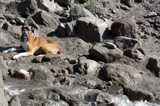
So, I tossed Rocky and my new Salewas in the car for a challenge hike.

I haven't been to Paradise Park since 2002, which is downright silly, since the wildflower meadows there are some of the most prolific on Mount Hood. Heading out from Timberline, Rocky and I immediately entered the low-lying clouds snuggling with the mountain on our way down the trail. Surprisingly, the Salewas felt like nice, comfy gloves on my feet. Heavy gloves, but still warm and comfortable. I had been extremely pleased with the fit in the store, but getting them out on the trail was another thing entirely. I felt like a giant as I stomped with impunity through trail mud and creeks left over from the recent rains. Ah, Gore-Tex.


a fog-shrouded Little Zig Zag Canyon

Upon reaching the gaping slash that is (the big) Zig Zag Canyon, the clouds suddenly dissipated, Mount Hood emerging from the gloom. Across the canyon I could just make out the fields and fields of purple lupine gracing the fields of Paradise Park. 

Dropping into Zig Zag Canyon is always fun. Basically, the trail drops straight down on well-graded switchbacks through dense forest, spits you out at the Zig Zag River, and then asks you to regain all of that lost elevation on your way up to Paradise. The best part? You get to do it all over again in reverse  on your way out, when you're already tired.

True to form, my feet started doing strange things on the downward plunge into Zig Zag. Damn. I pulled off the Salewas while Rocky lounged by the river; hot spots, but no blisters yet. I eyeballed the climb out of Zig Zag, longing for the meadows of Paradise. The loop was only about another five miles total, but I wasn't sure if I wanted to pulverize my feet quite so much, blister-free guarantee or not. So, Rocky and I turned around, trekking back out of Zig Zag to Timberline, my backyard mountain playground showing a different face entirely in the long fall sunlight gracing the trail on our return.


Verdict? Blisters. Two of them. Clearly my feet need to be lab monkey boot testers for companies with blister guarantees. The search continues.  


Tender Foot

Mile 8.2 at Jack Lake. Blisters already. [Insert expletive here.]

SANTIAM PASS-CANYON CREEK MEADOWS-PCT LOOP
Mount Jefferson Wilderness, Oregon
~ 25 miles, ? elevation gain (nope, no idea)

Last year, during my Three Sisters trip, I began to fall in love with solo backpacking. That sense of not relying on nor being beholden to anyone but yourself, no compromises. It is not a feeling I always seek, but for me, that sense of solitude and self reliance brings a deep sense of calm and quiet, a reset for the soul. In the month I have before nursing school, I want to do several backpacking trips. My goals: challenge myself to longer loops, more solo hiking, and check several bucket-list trips off the list. 

  • The Dollar Lake fire currently scalding the north side of Mount Hood effectively killed any Timberline Trail plans for this year. [Grrrrr]

  • The CD player in my Subaru fried a couple of weeks ago. This makes me feel lazy about driving the five + hours north to the Glacier Peak Wilderness. Music takes my mind off the monotony of driving by myself, and I am not the most patient radio channel surfer.

Jefferson Wilderness it is.

The backpack trip I really coveted was the Jefferson Traverse, outlined in Douglas Lorain's Backpacking Oregon, but lack of a car shuttle made that trip impractical. So I modified a large loop to begin at Santiam Pass, explore the area east of Three Fingered Jack, then head north along the PCT past Minto Pass and Rockpile Lake, finally winding my way back through the Eight Lakes Basin. 

Starting from Santiam Pass at 1 pm, I eyeballed the wildfire burning just across the highway in the Mount Washington wilderness before continuing east and north on the Old Summit Trail en route to Canyon Creek Meadows. This was my first backpacking trip completely solo- at nine years of age, Rocky tires more quickly with long mileage and heat, so I decided to leave him at home. I had also managed to get my pack weight down to twenty-four pounds (minus water) for a three night/four day trip. This may not seem light for the ultralight hikers out there, but for me, it's a record, and I was thrilled.

wildfire in the Mount Washington wilderness

 
One of the most unique aspects of the southern portion of the Jefferson Wilderness is the destruction left by wildfires. In 2003, the B&B Complex torched over 91,000 acres, and in 2006 the Puzzle Fire crisped another roughly 5,000 acres.

Old Summit trail, beginning to disappear in the burn

Three Fingered Jack from the Old Summit trail


That said, there is something remarkably stark yet beautiful about hiking through old burns. A contrast of silvered snags and green meadows, the landscape stripped down to its bones, all wildflowers, clean silhouettes and outlines. Beyond Booth Lake, meadows and brush are reclaiming the trail, and I found myself fighting Mother Nature with creative expletives. It was slow work around a multitude of blow downs; in certain places my route resembled deep creek bed rather than trail; in other places, trail mysteriously disappeared only to reappear several feet away behind thick brush. I stopped several times to 'de-beach-ify' my shoes; trail dust and sand had worked its way into my trail runners to such an extent that I felt elevated in my own insoles. I believe the constant friction from the dust is what contributed to the nasty, nasty pinky toe blisters I had by the time I reached Jack Lake.

oh yes, all of that came out of one shoe


While I am glad to say I have now explored this trail, I personally am not sure it warrants a revisit anytime soon.

giving the Old Summit trail the ol' middle finger


Canyon Creek Meadows, on the other hand...wow. I arrived tired and footsore, approximately eleven miles from Santiam Pass, to absolute solitude, all the day hikers returned home to beers and showers. Only two miles from the Jack Lake trailhead (yes, I could have driven to Jack Lake, and saved myself some blisters), I can see how Canyon Creek Meadows teems with throngs of day hikers. A small pocket of wilderness not sacrificed to the wildfires, the meadows fill your entire focal scale with wildflowers. But I was there on a Thursday, arriving at 7:30 pm to not a soul in sight. I wandered another mile or so up to the head of the basin and found a lovely campsite, the craggy face of Three Fingered Jack staring me down.

if my mother could see me now


Stars, the remaining vestiges of the Perseids, Craggy Jack and icy alpine air were my only companions that night.

Popping out of my tent to brilliant skies, I startled a young doe not ten feet from me. We both went motionless and engaged in a staring contest, neither one of us moving except for me to smile and her to frantically twitch those over-sized ears back and forth. She finally bounded off, leaving me to make my coffee and warm up in the morning sun like a lizard on a log.

Canyon Creek meadows site


Upon analyzing my blisters the evening prior, I had killed my huge loop dreams, prioritizing saving my feet from utter destruction for the month ahead. Theoretically, I could hike the remaining miles to Santiam Pass, but hoped I would find a campsite en route to stay another night or so.

I reentered the devastating burn not long after leaving the meadows, making my way towards Wasco Lake and the moderate climb to Minto Pass, which my feet did not enjoy. I did, however, find nummy huckleberries, which my taste buds loved and provided a pleasing distraction.


motivation up Minto Pass


Begin the thru-hiker parade.

Every time I meet a thru-hiker, my heart aches with a jealous longing to join them on their nomadic trek north. Something about those endless miles, the sense of a journey both physical and mental, appeals to me on a deep scale. One in particular, Crasher (I'm sure there's a great story behind her trail name), was exceedingly kind and chatted with me for several moments before continuing her cruise north.

Here, the PCT passes in and out of burned forest and winds its way around impressive views of the north face of Three Fingered Jack.

Three Fingered Jack from the PCT


I found a lingering snow melt pond and decided to call it a day. An isolated pad with just enough space for my tent was hidden beyond the pond, and I set about hastily making camp- not only did I need to check out my feet, but the pond's resident mosquito population had found dinner.

(Having not brought any bug spray with me, I have well over one hundred bites. I think the Jefferson Wilderness breeds an entirely new and formidable species of mosquito. Normally I don't itch that much, right now, I'm clinically insane).

During the remaining afternoon hours, I entertained myself lancing blisters, reading and creating a little mosquito graveyard in my tent.

Around 7pm, the temperature suddenly plunged, and the wind picked up...big, shaking gusts, whistling through the trees and rattling my tent so hard it was lifted against the stakes holding it to the earth. Wildfire smoke began filtering its way up the PCT from the valley, setting the sky ablaze with color.


I slept reasonably well, but it was still a long night, the wind howling and rattling my tent like a freight train throughout the night and into the dawn. That morning, I was so cold, I actually drank my coffee in my tent, wearing everything I owned, while I packed up.

I'm cold


That said, the remaining approximately six-ish miles passed in a cold, blustery, and spectacular fashion. One of my beloved hours to hike is the early dawn when the world possesses a sense of still slumbering, of anticipation. The details are richer, yet more subtle, the light soft. I wish I hiked more often at dawn; however, I find that the actual getting out of bed process tends to interfere with this favorite time of the day to hike.


Again, at the trailhead, I take stock: eight blisters, stinky, mosquito-bitten. Hungry for real food. Tired. Deliriously content.