Pages

A Very Different Goat Rocks

SNOWGRASS FLATS TO GOAT LAKE BACKPACK, 8/11-8/13/2011
Goat Rocks Wilderness, Washington
13 miles roundtrip, ~1770 feet elevation gain

The unbelievable has happened. We have Goat Lake to ourselves.

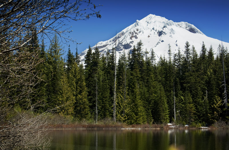
At 6400 feet, Goat Lake sits in a high alpine bowl in the Goat Rocks wilderness in Washington State. Sandwiched between the three Cascade giants of Rainier, Adams and Helens, the Goat Rocks are the blown-out, spiny remains of an extinct volcano and showcase some of the most spectacular scenery in the state. 

It is also usually mobbed. 

And this is the only reason why it is not currently bombarded by human and dog foot traffic.

Um? Hello? Summer? (photo by AJP)


The Goat Ridge-Snowgrass Flats loop provides one of the few, easily accessible loop options within this outstandingly lovely alpine wilderness. And Goat Lake, with its wide open views of Adams and its ridge hugging trails wandering through fields and fields of alpine wildflower heaven, sits at the epicenter of the loop.

Getting here has been a challenge this year. Mid-August, yet it looks more like late June or early July. 

As part of our annual Perseids trip, Andy and I chose to head up to Goat Rocks this year knowing that condition reports were sketchy, so we left for the weekend with no particular game plan. There was no mileage agenda, no destination-itis: we wanted to star-gaze, moon-gaze, practice some night photography and stalk some mountain goats from a distance. Just being out was enough. 

We found the moon. We saw goats, had an early morning camp marmot visitor and walked across lots of elk evidence. And the Perseids, though faint due to moonlight interference, were abundant, streaking their long way across the night sky.

We headed up the Snowgrass Flats trail on Thursday afternoon, opting to try the loop counterclockwise, since the Cowlitz Ranger District had updated a condition report (finally) that the trail was logged out and clear of snow to the junction with the Lily Basin trail. Personally, having walked this loop before, I find it to be more scenic clockwise; although the Goat Ridge trail is steeper, it is far more scenic, and I prefer views to a long forest slog. We chose Snowgrass though, since we weren't sure what we would find higher up. 

It was the right choice. 

We stayed below Snowgrass Flats on Thursday night, wandering wet meadows only just melted out, photographing green shoots and early flowers inching their way through the still muddy earth. Several groups were camping there on Thursday night but nothing, nothing compared to the starved backpacking hoards headed up when we would leave on Saturday.

recently thawed meadow & the Goat Rocks


We sat and star-gazed for hours, the moonlight bright enough that no headlamps were necessary.

Friday morning we lazed about before deciding to see how conditions were at Goat Lake. From our camp on Thursday night we could see the basin, still very, very snowy. We had been warned by one individual that getting there was "dicey".

where we are headed: Goat Lake basin


Just beyond the main creek in the camping area below Snowgrass, the trail began to rapidly disappear under snow. Huge bowls full of snow. The sound of water everywhere, running underneath your feet. Blinding sun. And little pieces of greenery here and there, beginning to raise their heads through the still lingering winter. As we began the final climb to Goat Lake, the sun had already worked its magic, the hillsides greener here, with phlox and avalanche lilies galore carpeting the slopes.

route finding
(photo by AJP)


And then the traverses. Two of them.

On its final, winding way to Goat Lake, the Lily Basin trail traverses steep slopes in a valley filled with tiny, seasonal cascades. By the time we arrived, the snow was softening in the midday sun. Even with my Kahtoolas, the first traverse, though not long, had my heartbeat drumming in my ears.

the first traverse

The second traverse was longer, and the exposure of consequence. Halfway across, fully committed, I was downright nauseated and cursing myself for my stubbornness. My downhill foot kept sliding in the sun-soft snow, causing my vertigo to rear its ugly head and my sense of balance to careen out of control. This type of challenge is not my forte, and it took every ounce of mental steel to keep myself putting one foot in front of the other. But there was no turning around on this narrow, foot-wide, beaten shelf of slick snow.

this was NOT intelligent (photo by AJP)


I was a shaking mess by the time I reached the other side.

the second traverse as seen from Goat Lake


Nature cannot be tricked or cheated.  She will give up to you the object of your struggles only after you have paid her price.  ~Napoleon Hill

post-traverse trauma: sunburned and mentally fried

So it was that we came to have the still-frozen Goat Lake to ourselves, not a soul in sight.

Locked in a seasonal time warp, Goat Lake remains buried under massive drifts, only the barest outline of its turquoise lined banks cracking through the mounded snow. Goat Creek can be heard under your feet and is raging at its outlet as it drops off the cliff face below the lake basin. We claimed the one and only melted out campsite for the evening, watching mountain goats graze on the cliffs above us. As evening progressed, Mount Adams became bathed in alpenglow while the moon rose, full and clear over Old Snowy and Ives Peak. Later, meteors and that rushing wind that always fills the Goat Lake basin in the evening hours would keep us company.


goats!

Mount Adams alpenglow

moonrise over Old Snowy and Ives Peak

starry starry night

We had decided that in the morning we would head back the way we came, banking on the snow refreezing overnight and thus providing us with better traction. It was a good gamble; actually, the only gamble available. Beyond Goat Lake, where the Lily Basin trail climbs to the junction of Hawkeye Point and the Goat Ridge trail (just above Jordan Basin), cornices were still visible, and I knew from previous trips that the exposure there is deadly. No mistakes were possible on that section of trail. So, no loop on this trip.

In the still early morning, the traverses passed relatively quickly, the now solid snow providing the sticky consistency our microspikes excel at gripping. The previous day’s nauseating scare behind me, it was smooth sailing back to the trailhead.

better, but I still do not like you

Andy has 40+ mosquito bites. He’s itchy and annoyed, but we both agree this was an unforgettable trip. A very different and unique face to the Goat Rocks, one of our favorite wilderness wonderlands.

Lily Basin trail just before the second traverse
Goat Lake basin & Mount Adams (photo by AJP)

best window in the world (photo by AJP)


My Mountain

COOPER SPUR
Mount Hood Wilderness, Oregon
~8 miles, ~2800 feet elevation gain

Eliot Glacier icefall


Perched high on Mount Hood's northeastern flank is Cooper Spur, a beautiful but barren landscape swept clean by wind, scoured by the harsh realities of nature at this altitude on the mountain. 

For me, it is spiritual place, the narrowing down of the self, the confrontation with the realization of your insignificance in the world and the humility which comes with that reality.

It is nothing but footsteps on ravaged soil, and the burning of lungs with each step higher. It is harsh sun, your eyes forced downward in the glare. It is tenacious, scrubby flowers scrambling for purchase on pumice-ridden slopes. Ancient ice fall. Long views across the horizon. The only constant is the ever-changing face of the mountain (with the seasons, with the light, with the altitude gained with each fighting footstep and breath) looming before you.

This is one of my favorite places. 


Mount Jefferson & the Three Sisters are visible today

Tie-in-Rock lies beyond the last bit of trail


Deciding to do a 'standing glissade' down the trail

all-wheel drive helps

where I came from


Cooper Spur shelter & Mount Adams


The Hills Are Alive


ED'S TRAIL
Silver Star Scenic Area, Washington
~5.5 miles, 1440 elevation gain 

Mount Saint Helens from the Chinook trail


Meadows as far as the eye can see and flowers galore, running rampant along the slopes. Sound of Music stuff. Butterflies. Indian paintbrush, lupine, beargrass, tiger lily, wild iris, spirea, wallflowers and countless others I cannot name. Sprawling views. A return to Silver Star.

Saturday morning. The last minute cancellation of previously scheduled family activities leaves the day wide open. Rather than un-cancel the previously cancelled plans with the other individuals I had already cancelled on, Andy and I decided to tackle the day together in exploration (my favorite hiking partner to enjoy the remains of summer with).

A few weeks ago, a new adventure buddy introduced me to the Silver Star scenic area in Washington. From atop Little Baldy’s crumbling summit and across a small valley, she pointed out the ridge top Ed’s trail, traversing its narrow, winding way towards Silver Star’s 4390 foot summit, amid lush green meadows and unique rock formations. 

We went there.

Road 4190 presented one interesting berm/wash to cross, and even my Subaru had mild issues with it. I am now well-acquainted with the smell of toasted rubber. Thank goodness the trail that is Ed's is in better shape than the road leading up to it. 

Ed's trail


Like the Bluff Mountain trail, Ed’s trail stays high among the countless flowers and tree-less ridge walks so characteristic of the Yacolt Burn area. About a half mile from the trailhead, the trail begins to traverse a steep hillside as it overlooks an open valley, and the expected eye-candy views abound. One portion of trail, just beyond the rock arch, requires the use of hands to scramble up the slope, including the use of a stout and well-positioned tree root, also known as "vegetable belay". 

rock arch on Ed's trail

trail? trail.


I do not particularly care for this kind of stuff. Sections of trail like this cause my vertigo to kick in with a vengeance, like a team of draft horses stomping on a whining puppy. Still, it's good to challenge oneself, and I’d rather climb up than down, so up it was. Prior to the rock arch, if one watches carefully, a side path jumps off from Ed's trail to join the Chinook Trail; an old jeep trail, the Chinook trail is much less narrow, and it parallels Ed’s trail on the opposite side of the ridge, eventually hooking up with the beginning of the hike. If conditions were wet or if one has small children, a better option might be to take the Chinook trail to Silver Star’s summit.

Silver Star from Ed's trail


Once atop our actual goal, we lingered, watching the clouds dance around in unseen wind patterns while Mount Hood played peek-a-boo with our cameras. Taking a relaxed pace out, we followed the Chinook trail through yet more meadows, Helens and Rainier as our constant companions. 

watching the clouds play


These are the reasons I live here. 

Ah. Summer...

LITTLE BALDY VIA BLUFF MOUNTAIN TRAIL
Silver Star Scenic Area, Washington
8.4 miles, 1600 elevation gain

...has finally arrived. Although it took its sweet time coming up to the Pacific Northwest, our long, consistently warm and sunny days finally appear to have begun en force. And July has started off brilliantly.  

I'm revisiting old haunts and exploring some new places with some new people and one of the coolest little trail dogs, ever.

meet Oscar

Thank you, Allison.

North of Portland, sprawled across the landscape east of Battle Ground, Washington, lies an area known as the Silver Star Scenic Area. Torched by the Yacolt Burn of 1902, natural reforestation has never regained much of a foothold in these hills. As such, the area is characterized by incredible, lofty views all around and some fascinating, wildflower-filled ridge walks. Trailheads are reached via crappy forest service roads (potholes seem to be this month's theme), and deer that like to play games of 'Chicken' with your car.

Helens, Rainier & Adams from Little Baldy


I suspect Allison nearly choked when I told her I had never visited the Silver Star area, and my ignorance sealed the deal for Saturday's hike. She directed me to the Bluff Mountain Trail in a quest to climb a crumbly, scree-sloped old summit known as Little Baldy.

Little Baldy from Bluff Mountain trail


The trail stays high and follows an old jeep track before spitting you out onto something resembling true trail at around 2 miles. The wildflowers were profuse; I have never seen such a gathering of Indian paintbrush. Beargrass was prolific but currently not in its blooming cycle. I imagine when it is, these meadows are beyond breathtaking.

The next few miles traverse under a cliff face, cross a few, wee seasonal streams and deliver the predictably lovely views of Mount Hood, Mount Adams and Mount Saint Helens.

Upon rounding the side of Little Baldy, we began looking for a way up top. Silver Star Mountain sat before us, another two-ish miles away. I determined I'll be heading over there, soon.

Allison & Oscar, trail detectives


Here, my new hiking companion went bionic on me (damn, that woman can hike), and I met her on the summit of Little Baldy, 3940 feet, in my own good time. We were kept company by bees, ants, penstemon flowers, views, a cool breeze, peanut butter and jelly sandwiches, and a most excellent batch of homemade oatmeal raisin cookies. Score.

going bionic

Silver Star from Little Baldy


Mount Saint Helens

MOUNT SAINT HELENS CLIMB
Worm Flows Winter Climbing route
~12 miles, ~5600 feet elevation gain

The weather gods cooperated.


We last climbed Mount Saint Helens eleven years ago. In summer, the Monitor Ridge route is basically a long pumice and boulder-ridden slog; although there is a barren, exposed beauty to the route, it’s brutally hot on a sunny, warm day, and I distinctly remember hating the traction (or lack thereof) hiking up the scree-ridden trail. Footing was just downright questionable at times. 

Since that hike, our local lady has thrown a few minor fits, including building a new lava dome within the crater. I also have to say that prior to last year, beyond our one summit hike, we hadn’t really explored the trails around Helens much, and she is quickly turning into one of my favorite local playgrounds. The entire area possesses a truly unique quality not found in other nearby hiking areas.

This year, snow con­tinues to linger and the Forest Service still has not opened the Monitor Ridge route to climbers. As such, our route to the summit would follow the Worm Flows winter climbing route, which was new to both Andy and me.

Monday evening, to avoid our local neighborhood July 4th party people, we packed in and made camp around 3800 feet. Prior to leaving the Marble Mountain Sno-Park, we spoke with several of the day’s climbers regarding last minute conditions: snowshoes? (overkill). Crampons? (not necessary, but probably also not a bad idea). Oh, and to be careful near the summit. One woman stated she got a little too close to the edge, punched through a piece of the cornice and “…almost saw daylight. When you see Rainier, be worried.”  

Alrighty then.

Our July 4th was perfect. Just Andy and I, above timberline, the stars, the quiet, and absolutely no one else around.


can you find the Big Dipper?


Morning dawned cool but not cold, and overnight the snow near our campsite took on a solid but sticky, consistency. We began climbing at the leisurely hour of 6:15 am; a party of three and a solo climber passed by about 45 minutes earlier and we would only distantly see their little micro-persons on the route afterwards.


Not ¼ mile from our campsite, we hit the first solid snow of the route. We would climb moderately, and then traverse off to the side to continue hiking up the actual worm flow. Here, the character of the hike reminded me very much of the hike up Monitor Ridge- crappy footing, the occasionally vague trail, and the sometimes necessary rock/boulder grab, which will tear your hands up if you don’t have gloves.

worm flows = crappy footing


I think I prefer hiking on snow.

We eventually came to a good point to hit the snow again. Neither one of us had done hiking like this in snow before; we donned our Katoolas and began the long kick-step process of making our way to the summit, still several thousand feet above us.


step, breathe. step, breathe.

Beautiful to watch the world wake up, to watch the dawn hit the mountains, to watch the sun creep over the lava flows and slowly light the snow into a blinding brilliance. Sunglasses and sun block are absolutely necessary in these conditions.

Adams in the early morning light


At only one point in the climb did I truly become uncomfortable, just prior to a false summit. No altimeter to record the exact location, but I’m guessing that somewhere just above 6500 feet the pitch of the climb increased dramatically, to the point where I felt distinctly nervous about a misstep. I concentrated on my footing, kick-stepping in at least twice and planting my feet solidly before attempting the next step.

steep stuff


Beyond the false summit, the pitch again became reasonable but the snow conditions became more questionable- sections of ice, deep snow, sun cups, and areas of exposed rock. Our biggest disappointment of the day: we had assumed (wrongly) that the edge of the crater would be somewhat melted off at this point, allowing us a good view into the crater to see the new lava dome. It is, in my opinion, the most dramatic part of Helens and the entire reason for the climb.

sitting a safe distance from the cornices


The cornices were nowhere close to being melted off. Given the recent spell of hot weather, they were highly unstable, and a ranger warned us to keep at least 25 feet back from the edge, but to “Use [our] own judgment.” Given that an experienced mountaineer died this year on Helens due to a sudden cornice collapse, we decided to leave the lava dome and crater view for another day. Disappointing, to be sure, but it can wait. The crater will still be there.


The best part of the entire day: glissading. Almost an entire 4000 feet of it, down to within a ¼ mile of camp. Now THAT is what I call fun.

Glissading Mt. St. Helens from Andy Park on Vimeo.

From Woods to Wildflowers

"You know, minus the potholes, this road is actually in pretty good shape.”

Andy just looks at me sideways as the Subaru lunges over yet another hole, jostling both of us enough to click our teeth together. Hard. 

“I think you missed some fundamental principle of what makes a road 'good', Amanda.”

It’s the first 80 degree weekend in nine months, and these gorgeous days just happen to correspond with July fourth weekend. Insert grin here. 
 

BURNT LAKE TRAIL
Mount Hood Wilderness 
6.8 miles, 1500 feet elevation gain

Yesterday, with Andy still caged at work, I took off with the Rock-monster for a much needed solo trek. I had originally planned to hit up one of my favorite places high in the Mount Hood Wilderness, Cooper Spur, but after a bit of a rough morning got a later start than I wanted. As such, I made an impromptu detour to the Burnt Lake trail, which I hadn’t done in years. The road to the trailhead there, too, was riddled with potholes, enough to leave some serious modernist mud art on the sides of my car.

Burnt Lake trail

The trail was a sun-dappled walk through a verdant, layered forest. Giant, burned cedars, the bones of the old forest, stood like sentinels among vine maple, huckleberries, hemlock, Doug fir, ferns, bunchberry and devils club. Trillium and bleeding heart sprinkled among the greenery. And a few boggy sections choked with slide alder and devils club, where skunk cabbage with its yellow, lantern-like bloom, thrived.

still-life with trillium & bug


At 4100 feet elevation, Burnt Lake has only recently melted out, but even on the first of July, large snow drifts linger, some taller than me. There was no one else around. Just warm ground, a warm sun, and lunch on an alpine lakeshore.

dah boy

requisite Burnt Lake shot


I love watching the world wake up, in that transition time between the sleep of winter and the vibrance of summer.

GRASSY KNOLL
Columbia River Gorge, Wind River Recreation Area
4.4 miles, 1200 feet elevation gain


The first true day of the holiday weekend. We puttered about the house, halfheartedly attempting needed house chores before deciding to throw in the towel and enjoy the day. Nothing too long, since it was early afternoon already and nothing too difficult since we still had plans for a Helens backpack/climb on Monday and Tuesday. Just a sunny, warm leg-stretcher on a glorious day, and hopefully not too mobbed with holiday crowds.

I picked Grassy Knoll out of hat. Basically stuck my finger in a guide book from the library and said, let’s go there. Which leads us to the road reference above. Still, Bear Creek Road and later, Forest Service road 68, aren’t the worst roads we’ve been on. I’m going to currently leave that honor to the road leading to Breitenbush Lake from the Ollalie Lake area. That is a rip-your-oil pan-out-with-glee road. 

At the trailhead, Andy discovered that in his search for his hat, he had left his hiking boots at home. Since he’s stubborn, he hiked in these:

basically house slippers at this point


The first 1.2 miles of the Grassy Knoll trail provided a decent workout on steeper pitches than I anticipated. The reward beyond is to travel at a rolling pace amongst lovely rock gardens and meadows with sweeping views of Mount Adams, Big Lava Bed plain, Mount Hood and the Columbia River gorge.


From atop Grassy Knoll itself, the foundation stones of an old lookout tower are all that remain in a garden of flowers: phlox, sedum, balsamroot, lupine and indian paintbrush.


We could have continued on, rambling on through the myriad flowers and meadows over the ridgeline, all the way to Big Huckleberry Mountain. It was tempting, but it was already getting late, that glorious afternoon sun backlighting the meadows in a spectacular fashion.