Pages

Soggy Shoes


DAY ONE:  Last year, a new adventure buddy introduced me to Silver Star Mountain. I haven't had the opportunity to hike with Allison since, so when she impromptu invited me on a Mount Adams overnighter last week, I jumped on the chance to head into the backcountry after a long, forced celibacy from hiking. School projects caused me to bail on Adams (apparently, a good thing), so when Allison decided to give the first backpacking trip of the season a second try, I was all in, school projects be damned.  

I will make an effort to get out for self-care this quarter. 

With the high country still very snowy, Allison proposed hitting up the northern section of the Mount Saint Helens National Monument, an area she explored for the first time last year around Goat Mountain. For this trip, we settled on a different approach to Deadman's Lake, entering via the Goat Creek Trail, and climbing some 2400 feet in the almost nine miles to the lake (most of this elevation gain was in a four mile stretch as the trail approached Vanson Lake). 

The trailhead was literally in a cloud when we arrived around 1PM; however, these were perfect conditions for the trail ahead. Simply put, the Goat Creek trail is spectacularly beautiful, classic Cascadian old growth, wealthy in fern, trillium, oxalis, thimbleberry, salmonberry, devils club, slide alder and moss. We crossed a multitude of creeks and lovely 150 foot Leona Falls. Just beyond the junction with the Tumwater Ridge trail (our return path), the trees grew bigger while the trail became significantly brushier and laden with moisture. Within two miles, we were both soaked from our trail runners to our shoulders. It was a theme that would continue for the three days we were out. 


Leona Falls
In Georgia, this would be chigger territory (photo by A. Wildman)


This section of our loop was generally in good shape, and I found myself completely enamored by the beauty of this dense, deep forest. Although cool, the humidity was nevertheless incredible- I was sweating buckets and slowing down to tortoise speed on the uphill climbs. The temperature dropped as we gained elevation and near Vanson Lake, we passed through some lovely alpine meadows still melting out from winter snowdrifts. From a high point of 4700 feet on the ridge, we would drop 400 feet down to the shore of Deadman's Lake for the night. 

beautiful Goat Creek trail

On our way in, Allison and I chatted about why we like backpacking. For both of us, it's a combination of solitude and challenge, a hitting of the reset button. Allison framed it really nicely that it's about making yourself a little uncomfortable for a few days; when you get home, life gets put back into perspective, and you appreciate comforts that much more. For me, backpacking shuts off the brain chatter- by physically exhausting myself, the world narrows down to greenery and the focus on simple things: walking, food, shelter, water. 

back in the clouds, nearing Vanson Lake

Since Allison is a much stronger hiker than I am, we separated on much of the trek to the lake. She is all thoroughbred-long legs, ground-eating stride and grace- while I am more like a stubby pony- short and slow but stubborn to get where ever I am going. I was pleased to see that she didn't seem to feel the need to wait for me, and equally pleased to discover that I am no longer frightened to be alone in the woods, which is something most of my friends don't understand and which I've given up trying to explain. 


I had MAJOR pack envy on this trip- I'm on the left, Allison is on the right

Deadman's Lake was quiet when we arrived, with only two other small groups camping there. Characteristic of the day, it was foggy and cool. That night, we would be serenaded by owl call, no elk, and (unfortunately) my opera-loud snoring, which I had failed to warn Allison about ahead of time. Yup. I have pipes.
I kept Oscar up with my snoring, too

DAY TWO:  The loose plan for the day was to jaunt up to the Goat Ridge Mountain trail and take in (hopefully) views of the mountains and the Mount Margaret backcountry. Allison and I had done our best to dry out our clothing, shoes and socks from the day before to no avail- everything was damp and smelling of hiker-funk which made it really, really fun to put back on. That said, drying everything out was futile anyway....on the climb out from Deadman's we were greeted by heavy, dew-laden brush, soaking us all over again, leaving us with squishy trail runners in no time. By this time, I was really sensing a theme to the weekend.  

dewy false hellebore


Busting out around a corner to the views from the Goat Ridge trail made all the jungle rot worthwhile, even when the mosquitoes suddenly converged on us (neither Allison nor I could figure out why they were obnoxious higher up, but completely tolerable in the lake basin). The Goat Ridge trail is on the edge of the 1980 blast zone, and the ridge walk is a dramatic juxtaposition between the recovering green of the forest and silvered snags left over from the blast. 

It is also wildflower heaven. 

[On a side note, one truth about me: I am definitely a lover of the high alpine. As such, this loop trip was not the type of trail I would normally choose, especially for an overnighter. However, as the trip wore on, I discovered an appreciation for a different kind of beauty, that of deep old forest with limited views, where the beauty is in the tiny intimacies of the greenery all around you. By the end of the trip, I was really in love with this loop.]


We sunned for a while, futilely trying to dry out shoes and socks, before giving up and exploring beargrass meadows and playing games of hide-and-seek with a very damp Oscar. The clouds rolled in and out of the valley, playing peek-a-boo with the Mount Margaret backcountry. 


Allison watching Mount Margaret

Oscar watching Mount Margaret

Mount Margaret peek-a-boo

beargrass galore
Me, loving the alpine meadows of Goat Mountain (photo by A. Wildman)

By the time we returned to camp and packed up for Tumwater, the sun had finally broken through. I'll be honest, I didn’t particularly enjoy the five plus miles to a little unnamed tarn below Tumwater Peak. Unlike the Goat Creek trail, this was dry forest walking, where, in some places, the trail was being reclaimed by lots of blow down, the tread melding into the duff. There is one good vantage point of Rainier, Goat Rocks, Adams and the Mt. Margaret backcountry (all still very snowy), but overall the lack of views and flowers was disappointing for me. 

After cresting the ridge, we dropped down the trail to the unnamed tarn we would call home for the night. With no established camps, Allison and I were able to just barely eke out a somewhat acceptable site that was less than ideal, but that would do for the night.  

It was an entertaining evening. I managed to get my trail runners dried out by the smoky fire Allison browbeat to life, but nearly melted the soles off in my determination to not have wet feet. Oscar was sacked out in the tent being antisocial, and Allison had a major ramen dinner fail that she managed to salvage without adding too much pine needle flavoring to her meal. 

antisocial Oscar

ramen FAIL: adds piney flavor

Ah. Backpacking. 

Earlier in the day, while hunting for a site, Allison and I noticed a healthy population of frogs in the area. At 9:30PM, the chorus went off. 

"CUE THE FROGS!" Allison hollered from her tent. 

I fell asleep to a symphony of frog song that night. 

DAY THREE:  The next morning we putzed about, hoping for the sun to hit the basin for long enough to dry out our, once again, soaked gear for the hike out. Overnight condensation had left everything sopping. In the end, I gave up and shoved my now-pound-heavier tent into its stuff sack for the trip out. On the plus side- my shoes were still dry. As we began the plunge down to the trailhead, I noted how this side of the Tumwater Trail was simply beautiful, reminiscent of the Goat Creek trail on our first day in. That said, it is steep, and if I am to ever do this loop again, I will continue to approach it in the counterclockwise direction. Overall, we made decent time back to the trailhead for the drive back to Portland. And, irony of ironies, two stream fords less than three miles from the trailhead left us, once again, with sopping wet shoes. 

Allison & Oscar descending the Tumwater Ridge trail

lovely Leona again

Several days later, while dry, they still reek of hiker funk and have been banished to the outside. 

Ah. Backpacking. 

GOAT CREEK-DEADMAN'S LAKE-TUMWATER RIDGE LOOP
Mount Saint Helens National Volcanic Monument, Washington
~24 miles, ~3900 feet elevation gain


Recovery


July 5th, and I make the mistake of choosing a trailhead that begins at an interpretive center (Johnston Ridge Observatory). Still, true to form, the tourists dissipate after the first mile, and we are mostly alone from that point forward. We are tired and missing our dog, only a day after losing her. It's an afternoon that isn't so much about the hike but more about spending the time just walking, taking in late summer sunlight and the wide open, barren expanse on Helen's north side, beautiful in its own way, a testimony to recovery.

The "Breach"

hikers along the Devil's Elbow

hummocks on a devastated, but recovering landscape


BOUNDARY TRAIL: JOHNSTON RIDGE OBSERVATORY to HARRY'S RIDGE
Mount Saint Helens National Monument, Washington
~10 miles, ~1000 feet elevation gain


Iron Pug

My grey girl (June 2012)

In October, 2003, we brought home Yobo, a little gal from Pacific Pug Rescue with a history of abuse. She has been my constant shadow ever since. A good friend jokingly dubbed her 'Iron Pug' due to her amazing will and ability to conquer (up to) twelve mile hikes despite short legs, a flat face and a rotund frame. Last night, at 3 am, we lost our wee girl to health problems that just finally caught up with her. What an amazing, almost nine years of tons of diva personality in a tiny, fifteen-pound frame.

Some of my favorite pictures and adventures with my loyal girl:

I swear, this picture is NOT posed (August 2004)

only a pug would use lava rock for a pillow (Three Sisters Wilderness, 2005)


Buddies (Goat Rocks Wilderness, 2004)

this hike was just a little too long (January 2010)

The rare, elusive, not-often-seen snow pug (Dog Mountain, March 2010)

hippo yawn

sleeping bag warmer (Mount Hood Wilderness, 2010)

still life with pug and waterfall (October 2010)

under my chair while I studied
smoosh

giving me the crazy eyeball to get up the couch


Spring/Summer

OLD SALMON RIVER TRAIL
Mount Hood National Forest, Oregon
~5 miles, ~100 feet elevation gain


The last day of spring and the first day of summer. It's one of the first, really warm (for Portland) days of the year. I was supposed to be out of town this week, but plans didn't align quite right, so I ended up on a 'stay-cation' during the break between spring and summer quarters. It's turned out for the best as I have gotten an enormous amount accomplished this week and some quiet time to reflect upon things I have neglected- I have felt very much like being alone this week and simplifying the mental chaos in my life.

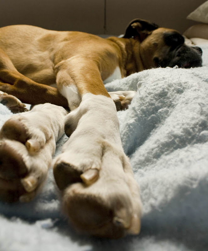
what old dogs do


With the mercury poised to hit eighty degrees, I was looking for a cool hike with plentiful water that was also short on mileage- at ten years old, my loyal boxer boy and trail companion, Rocky, is starting to show his age. I haven't visited the Old (Lower) Salmon River trail in many, many years, but it's always a beautiful choice, especially midweek or off-season. The trail is very quiet, the silence broken only by the sound of the rushing mountain creek nearby, and it's also a flat stroll on soft earth through ancient, mossy, forest. Although I would have preferred more mileage, I knew Rocky needed to get out as much as I did- I've been leaving him at home more often lately in concern for his feet and overall health (he still bounces around like a jumping bean whenever I get out the hiking gear though).

On this afternoon the trail was a verdant explosion of dynamic light ranges, a contrast of deepest shadows and brightest sunlight filtering through the canopy. There is a feel to old growth forest: the ground has a spongy, hollow quality to the loam, ferns and oxalis dominant the understory, and moss is everywhere.

Old Salmon River trail


I took my time on the walk, letting Rocky sniff and cavort, meander and wade, the walk as much for him as myself. I played with some macro photography and felt calmness settle over me, as the woods always blanket me in both forgetfulness and repose.

many, many idyllic places like this one along the trail


I had no idea this guy was even there until I looked through my macro lens


The Melt Off


Top Spur to the Timberline Trail
Mount Hood Wilderness, Oregon
~5 miles, ~1000 feet elevation gain

One of my most cherished, but brief, periods in the high alpine occurs just as the snow is melting off. The sleepy world suddenly wakes up, and it's game on for anything and everything before the snows encroach again. It's a time characterized by temperamental trails littered with blowdown, strewn with mud, seasonal streams run rampant, and new growth bursts forth underfoot. The woods are colonized first by avalanche lilies before, higher up, lupine, indian paintbrush, and beargrass bloom.  

At this time last year, I was butting my head up against numerous hike fails due to late season storms that had buried the high country; as such, our usual summer stomping grounds remained inaccessible until, in someplaces, mid-August. So when I suddenly just arrived at the Top Spur trailhead yesterday without having to drive over any patches of snow, I had a giddy little moment.

At 6100 feet, situated above Mount Hood's Timberline Trail, lies McNeil Point and its stone CCC shelter. The views are outstanding: the Sandy Glacier fall line, the headwaters of the Muddy Fork of the Sandy River, waterfalls, and, to the south, Yocum Ridge beckons.
Heading up from Top Spur to connect with the Timberline Trail is actually one of my least favorite approaches to the high country in the Mount Hood Wilderness. It. Is. Boring. Sparse, dry, forest walking. On days like this, it can also be surprising muggy and windless. The walking gets more interesting as you break out on to the ridge, dispersed with small beargrass meadows before entering the trees again. 

route-finding in the boring woods

 At about 2.5 miles from the TH, the world suddenly opens up. 


The original idea was to head up to the shelter, using the raw climber's trail etched into the hillside to climb the remaining half mile (and 800 feet) to play with our snowshoes on the deep, lingering snowfields higher up. Almost immediately out of the gate, however, Andy wasn't feeling well- overly tired and with odd, intermittent nausea. We made it to the viewpoint, reevaluated, then decided to call it a day. I could see the McNeil shelter high up, my snowshoes still strapped to my pack and whining to be used. I sat in the sun for a long while, my heart denying the decision to return home, my gaze longingly pinned on the vistas above us. 

I feel- no, I take that back, have been- pinned to a computer and books and clinicals and illness this quarter with no respite. I need to hit the reset button. Although I haven't gotten my fill of the backcountry yet, inside, I am doing a serious, serious happy dance.

I just got the green light for the mountains again. 


Sauvie Island Ramble


Sauvie Island (Portland, Oregon)
~27 miles

*Whew.* I passed my finals. (And to those of you who would scoff, yes, there was doubt).

Most of my classmates would agree, it was the quarter from hell. There was just Not. Enough. Time. To think that until last week I hadn't been hiking since April 1st flabbergasts me. With finals done, the rest of this week has been about pulling together the loose ends of my life I've neglected over the last ninety days. With obligations and chores finally, finally finished, I woke on Friday morning in something of a daze of what to do? After putzing about, still somewhat stupefied from my week, I called a friend last minute for a bike ride. 

Deliriously. Happy. To. Be. Done. With. Finals.

Ten miles north of Portland, sitting smack-dab in the middle of where the Willamette River, the Columbia River and the Multnomah Channel meet, lies Sauvie Island. At 26,000 acres, it is one of the largest river islands in the United States, and Portlanders love what has become a cherished recreational area. Sauvie boasts a plethora of U-pick farms (it's STRAWBERRY SEASON!), hikes, wildlife sanctuaries, waterways, and beaches (one of them for nudies). 


Although I've been on Sauvie a number of times (kayaking, fruit and veggie foraging and buttock hunting on the nude beach), I've never biked around the island. And anytime you find yourself on the island, you are sure to be greeted by little, colorful jersey parades pedaling the rolling, agricultural landscape. It's absolutely charming. Time to try it out.

Mount Saint Helens from Reeder Road

Marut met me in the little parking lot just off where the Sauvie Bridge spits you out onto the island proper. It was hot. I layered in sun block, then hopped over to the one port-a-potty in the lot (apparently reserved for TriMet bus drivers only) and somehow convinced Mr. Nice Bus Driver to let me use it. There are plenty of public honeypots along the island, but I suffer from hamster bladder syndrome, and this couldn't wait.

Business taken care of, we headed north on Sauvie Island Drive and connected with Reeder Road, ultimately headed towards the northeast end of the island, then retracing our path back to complete the loop via Gillihan Road. The afternoon passed in miles spent admiring rolling farmland, and watching the herons and ospreys contrast sharply with the giant barges making their lumbering way across the Columbia. 

bike picnic on the beach


Oh. And RULES OF THE ROAD: stay single file. Or you might get pulled over by a sheriff like Marut did for yakking at me too much while enjoying the day. [GRIN].


One Clam


Trying our skills at clam digging on the Oregon coast.

One clam. And lots of fun trying to outwit the little suckers from above. In the end, we ended up returning our one caught, wee razor to the sand (alive) since I simply could not justify eating a single clam, just because it happened that we only caught one. 

But next time, I'm making chowder.

lived to see another day

Procrastination

LEWIS RIVER TRAIL
Gifford Pinchot National Forest, Washington
~5 miles, ~500 feet elevation change

A meandering trail, a stroll, really, high above the banks of the Lewis River, occasionally touching down to greet the river's edge where water plunges over falls. Not a spectacular hike, but rather lovely and calm and oh so good to be outside, exploring an area I haven't visited before. The forty-some-odd elk scattered along the road's edges on the drive home didn't hurt either.

Five days until finals. 

Upper Lewis Falls

Withdrawal


I love planning trips. My wonderful husband, Andy, gets a giant kick out of teasing me that I enjoy the process of planning more than the actual trip (which might be just a tiny, itty bit true). We love to move, to see, to do, to visit, to explore. It's something of a ritual of ours to make a point to get out of town at least every three months on tiny vacays, and we usually try to take a big road haul of a vacation once a year. In February of last year, that big trip was Yellowstone, and I was fortunate enough to revisit my beloved España a couple of months later. Fall is our favorite season, and in September 2009 we drove fourteen hours from Portland to Alberta, Canada to visit Banff, Jasper and Yoho National Parks. We spent a week backpacking in Olympic National Park in 2008. Five years ago (2007 if you're counting), Andy proposed to me on the last day of a ten day driving tour of Alaska. And scattered in between and before those years were random ski and hiking trips to Powder Mountain in Utah and Grand Targhee in Wyoming. 

Jackson Lake, Grand Teton NP (photo courtesy of Andrew J. Park)
2009 Targhee ski car (what my car looks like all winter)


Among our most memorable incidents include a torturous, 35-45 mph crawl back from Arches National Park to Eden, Utah, courtesy of a freak snow storm [insert unexpected blizzard here]. 

Watching Andy ski/soar into the parking lot at Pow Mow, just barely missing another person's car on his way to greeting pavement (<= this was NOT a planned stunt/event). According to the shuttle bus guy, happens every year there. So, park your car accordingly. 

Bighorn rams grazing not ten feet away on Wilcox Pass in Jasper. 

(photo courtesy of Andrew J. Park)

A twenty-six inch powder dump and cat skiing at Pow Mow. Wasatch powder is simply epic

skiing the sugar at Pow Mow (photo by AJP)

Yellowstone & Spain belong in categories to themselves. 

The Denali wildlife, the gold and red of the tundra in fall, the wide-open vast expanse that is Alaska.  

The Alaska Range from Polychrome Pass, Denali NP (photo courtesy of Andrew J. Park)


Denali griz

The sheer, unique beauty of the temperate rainforest in the Olympics, and the bones of old growth giants bleached and raw on its wilderness coastline. 

giant cedar near Pyrites Creek, Olympic NP (photo by AJP)

the trail to Enchanted Valley

Hole-in-the-Wall at low tide

Hiking the Continental Divide in Banff's Sunshine Meadows

Rockpile Lake in Sunshine Meadows

I noticed the other day that I've been biking more lately (meaning training for Reach the Beach sucked down my available hiking/blow off school homework hours), and I haven't been on the trail since April Fool's. It's been a hell quarter; I want to believe I've made it over the hump of this fifteen month program, but I'm not so sure that is actually true. So, it makes sense, that withdrawal for setting out away from Portland, for any sense of exploration, for the wild world, is rearing its ugly head.

One week until finals.