Pages

Termination Dust


Alaskans refer to “termination dust” when speaking of the first fall snowfall. It’s that “dust coating of snow that appears on the mountain tops in fall, signaling the end of summer.”

Looking at Mount Hood looming before me, I can’t help but be reminded of that definition, and the late fall trip that Andy and I spent in Alaska, looking at termination dust on the peaks of the Alaska Range. I love, love, love fall. Truly, my favorite season.

Technically, it isn’t fall, yet. But the mountain doesn’t know that (and clearly doesn’t care). Last night, it snowed on me. 

Good morning, September (Skyscape tent by Six Moon Designs)


TOP SPUR TO WY’EAST
Mount Hood Wilderness, Oregon
~16 miles, ~2100’ elevation gain

With the new house purchase and projects (and it just being HOT), I’ve partaken in very little outdoor time this summer (negative note). Interestingly enough, almost all my forays out since June have been backpacking trips (positive note). Historically, September is a lovely month in the PNW and great backpacking weather; this year, though, summer came to a screeching and abrupt halt with the arrival of rains and dropping temps. So although I was eyeballing the forecast warily, I was determined to get out and see where it would take me.

I probably texted Andy three different itineraries before I left the house. A fourth itinerary change arrived in his inbox during a gas station stop when I saw Mount Hood was visible from I-84. Just couldn’t seem to make up my mind this morning but, upon seeing the mountain, I knew I needed the alpine. The question was, how tolerable was the mountain going to be of me? Timberline Lodge said 40°….

Part of the reason for this trip though was a gear test. I’m testing limits and learning my comfort zone still and nothing, nothing tests your gear and your backup plans like poor weather and a mountain. So, here goes nothing…

With my Brooks Range Tension 30 (<= LOVE that thing) still with the company for a repair, I rented a Six Moon Designs Skyscape tent to see how I liked it. I’ve been looking for a solo tent for a while in an effort to drop additional weight from my pack, and I’d heard good things about this company. I’ve been slowly shedding the weight from my pack (still working on the sleeping bag/filter weight issue), and the Skyscape could potentially drop another 15 oz off the weight.

It was 49° at the Top Spur trailhead as I began the 1300’, three mile steady climb up to the Timberline Trail. I wasn’t sure how far I would go this day- it all depended on weather and how I was feeling- and the plan remained loose. Two nights, maybe a base camp and some day hiking, maybe changing sites. Really, I just wanted to be out.

The last time I backpacked in this area, it was midsummer, full of bugs and wildflowers. The mountain wears a different face in the fall, no less beautiful, no less colorful, no less intriguing. There is an intimate sort of beauty to the slow wind down for the long, winter slumber. 

breaking out of the forest- Hood, Sandy glacier (snow dragon caves visible) and Yocum Ridge


At the turnoff to McNeil, I decided to press on, see how far my feet felt like carrying me. Up here, past the 5000’ mark, it was distinctly cooler, the sky threatening and grey, Hood playing a game of peek-a-boo with the clouds. I continued the up and down ramble along the Timberline Trail, leapfrogging with numerous groups hiking round the mountain.

(Someday I’ll do the whole thing. Somehow, I never get around to it. Perhaps it’s finally time to remedy that.)

fall colors on the Timberline Trail


Stream crossings though- they always make me nervous. And Hood has them aplenty. McGee and the Ladd proved uneventful (not always the case) but there are certainly bigger waters on Hood. 

crossing McGee creek


Just before Cairn Basin, I enter the Dollar Lake burn zone, absolutely eerie in the flat light. When I was last here two years ago, the undercover still hadn’t quite started to recover and many of the trees remained charred and black. Now, silvered snags greeted me and evidence of the summer’s wildflower explosion remained, testimony to the recovery of burn zones. Beautiful in a stark, surreal fashion. 

Dollar Lake fire transition zone

the burn is spotty in Cairn Basin

the Ladd crossing is always interesting


I still consider the north side of Hood, burns or not (Gnarl Ridge Fire 2009 and Dollar Lake Fire 2011), to be some of the most glorious wanderings on my backyard mountain playground. There is raw, spectacular, untamed feel to the wilderness here. Past Cairn Basin, I wandered into Wy’east Basin, one of my go-to places of the heart on Hood. I made the decision to stay here, maybe day hike up Barrett Spur the next morning. 

Hood peek-a-boo from Cairn Basin


True to mountain form, just as I found a suitable low-impact site in the trees, the mountain decided sleet was in order. Yippee.

I will say this about the Skyscape- it sets up fast and easy. I was concerned it wouldn’t feel too stable (some trekking pole designs feel downright flimsy), but it felt sturdy, was easy to stake out and was nicely roomy for a one person tent inside. And in Pepper and I went. She was done with the cold and immediately commandeered the sleeping bag.

I have no idea what the temperature was that evening, but whatever it was it dropped quickly and with a vengeance. The wind wasn’t the worst I’ve been in, but it was by far the coldest night in the backcountry I have experienced. 

(I feel cold just looking at this)

fall colors in Wy'east Basin


Oh, and upon trying to filter water for the evening meal, my water filter completely crapped out on me. And I had no backup plan. Yippee.  (<= poor planning, Amanda, poor planning). I still had about 1.5L with me, so not all was lost, but I forewent dinner that evening to spare water. I was also surprisingly not hungry, perhaps due to how cold I was.

Which is also something I continue trying to figure out.  I was wearing gear I use to snowshoe in- some bombproof Mammut softshells with a thermal underlayer, a Smartwool shirt over another underlayer, gloves, hat and a puffy. Still, it took some time completely buried in my 15° bag (while spooning a grumbling dog) to warm up.

I was pleased with the tent though. Also in contrast to my previous experience with a single wall tent, the Skyscape vents really well. I had nice airflow, which contributed to low condensation buildup (not none, just minimal). It had been raining all night, and the tent pitch remained taut, not bowing like I expected it to.

At about 3:30 am I woke up absolutely freezing and needing to pee. (Ah, backpacking). The tent felt slightly stuffy, and my initial impression was that the rain had finally gotten the better of the fly, finally succeeding in shellacking it to the netting.

Nope. Turns out, it was a nice half inch to inch layer of our infamous Cascade Concrete. Whoopsies. That will weigh any tent down.

I stepped out the tent to pitch blackness, completely clear skies, brilliant starlight, and a white world. Freezing and positively breathtaking. All regrets, all discomfort vanished. Ah, backpacking.

I spent some time beating the snow off the Skyscape and the pitch immediately rebounded. Truthfully, I was impressed that a trekking pole tent had remained that stable with that much weight on it. My old Nemo probably would have fallen on me. I watched the stars for awhile before I got too cold and the clouds came rolling back in, obliterating the sky. Back to the sleeping bag, snugged in and hunkered down for a few more hours.

In the morning, still too cold, I waited until the sun crested the horizon before finally getting out of the tent. The clouds were high with a dim, intermittent sun, but the mountain was out. I determined I *did* have enough water for coffee (those who know me know nothing happens without my morning coffee), but the lack of water, ability to filter combined with new snow kaboshed my plans for a hike up Barrett Spur. I just didn’t have the energy or ambition for it this morning. I had enough water to hike out, but in the interest of playing it smart, I just decided it was a head back home kind of day. 


Hood with new snow (Wy'east Basin)

Rainier & Adams from camp, Dollar Lake burn zone below

brrrrr

Going back the way I came, the trail was eerily silent and beautiful with its new coat of snow. Unlike a lot of people, I don’t tend to mind visiting the same trail twice or out-and-back hikes. I always find a new perspective. Oddly enough, although I had originally wanted two nights on the trail, I found myself content and relaxed in the way that wilderness only gives me. A sense of space in my head, a calming of the chatter. Funny how when the world narrows down to immediate realities, everything else seems small. 

snow pug

until next time, Hood


Summer into Fall

Hot dog

Swan Island Dahlia Festival

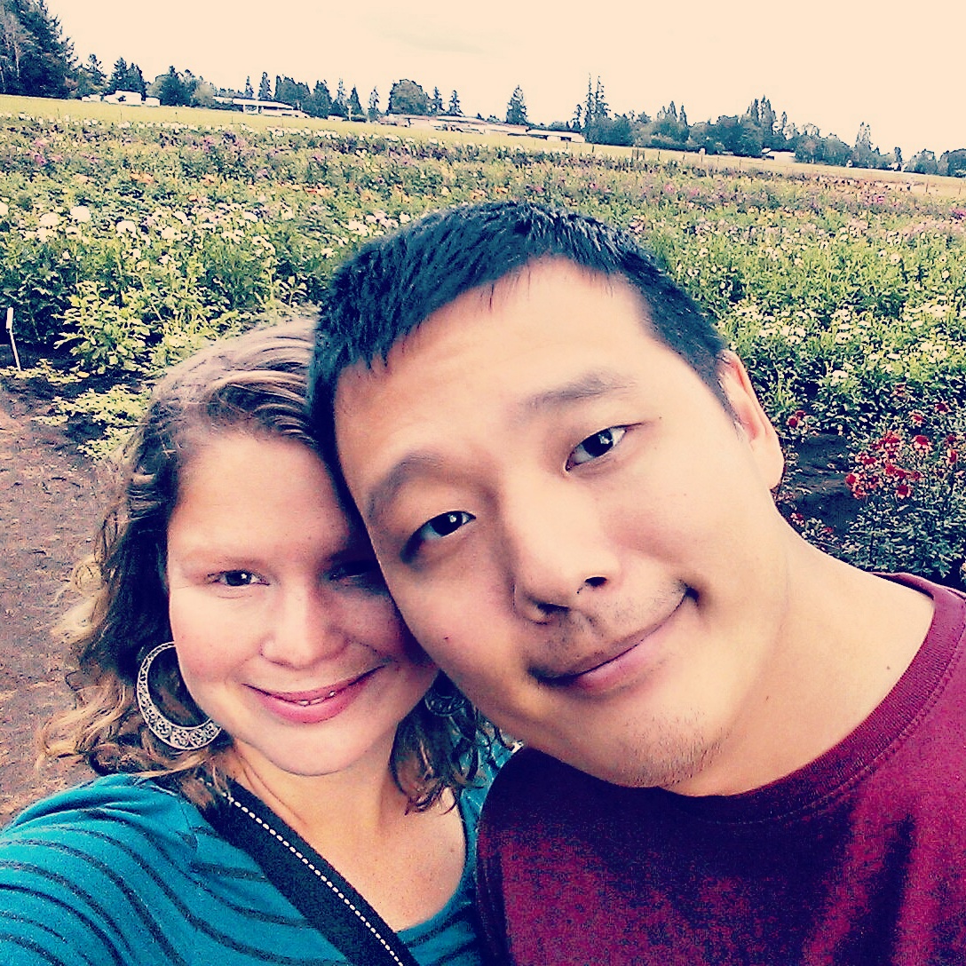
love love love this guy

cooler days mean coffee and blankets and snuggles

It's been an odd summer. Exceptionally hot for the PNW, which translates into less time outdoors for the not-so-heat-tolerant dog. We purchased a new home, which I had forgotten how much of a time sink that is. I just realized I've done very little day hiking (maybe none, in fact) and all of my trips have been either backpacking (awesome) or kayaking.

Summer seems to have come to an abrupt halt, with the sudden screeching arrival of cooler weather and blessed rain. Looking forward to fall and rebalancing my life with more trail time.

Goat Rocks Reminiscence


GOAT RIDGE-SNOWGRASS-CISPUS BASIN-NANNIE RIDGE TRAVERSE
Goat Rocks Wilderness, Washington
~24-25 miles, at least 2500’ elevation gain

Goat Rocks. There is no doubt it is one of my favorite places.

Ever since their maiden foray into backpacking last year, Sam and Shel and I have been trying to coordinate another trip (adult schedules are difficult to line up, it seems). Both friends were also interested in experimenting with slightly longer mileage and a multi-day trip. The Goat Rocks Wilderness packs a lot of bang into the mileage buck, so it was a good fit for adventuring further afield with multi-nights. Around every corner lies more enticing scenery, panorama and drama. It just somehow keeps you going. 

One of the many views in Goat Rocks that keeps you going (Day 3, PCT)


Par for the course with our trio there is the new gear trial- Sam hoofing in a new pack and me with another new (potential) dog. With 100° temps predicted in the valley (90s in the mountains), I left Pepper at home for this one. While Chewy seems to be a remarkably heat tolerant pup, Pepper just can’t handle that much heat. As a matter of fact, I wasn’t sure I could handle that much heat. This was an experiment for me as well (I moved from Georgia to get away from the heat after all). 

he didn't much care for the backpack


An early start from Portland still translates into an 11am start by the time we finish shuttling cars around trailheads. In order to properly introduce Shel and Sam to the Goat Rocks, I had us starting at the Berry Patch trailhead, working our way up Goat Ridge to Goat Lake on day one, traversing thru the heart of Goat Rocks country and Snowgrass Flats into Cispus Basin on day two, and, on the last day, heading out via Sheep Lake and Nannie Ridge to Walupt Lake.

The three of us badly needed this trip, the time and ability simply to get away from work and empty emotions into the landscape. The unit has been exceptionally difficult lately, and we all shared a sense of necessity in getting away, of letting go. Catharsis, zen, whatever you want to term it. And nothing quite decompresses you like mileage, stiff hill climbs, and heat. Good ol’ fashioned slog/sweat therapy.

DAY ONE: Appetizer & an introduction to Goat Rocks (Berry Patch TH- Goat Ridge- Goat Lake, ~6mi)

Heading up Goat Ridge, I found myself reminiscing. Goat Rocks was Andy and I’s first *real* backpacking trip in 2004. 

bleary-eyed at Goat Lake, 2004

It was the site of my first solo overnight in 2007 (scared to death the entire night, convinced some big bad creature was lurking just outside my tent door). Still the best stars I’ve ever seen (Goat Lake, 2004) and the best sunset (Jordan Basin, 2007). 

still the best sunset I've ever seen: Jordan Basin, 2007

Failed attempts at cross-country, high alpine lake hunting (Warm Lake, 2006). Dust, so much dust. Terrifying traverses. Trail magic. Four strangers coming together at the trailhead to help another couple load an incalcitrant llama into a trailer. Stalking goats and backpacking thru cow herds. Being almost 200lbs and struggling my way over terrain that today felt challenging but still so do-able, a win on the fitness/health meter for me. 

I have so many memories here. 

Jordan Basin, 2004 (first *real* backpacking trip)

this was a very different summer in mid-August 2011


A nice breeze kept the heat on the ridge climb out of the trailhead bearable, and once out of the trees, the bugs disappeared. Water was nonexistent until Jordan Basin, but the views certainly weren’t, and Sam and Shel were oo’ing and ah’ing around most turns. After the long traverse into Jordan Basin, we take a breather, gathering our thoughts and cooling off our feet, and begin the debate whether to push on to Goat Lake or stay in the basin. The decision won for a night at Goat Lake- although more crowded, it is difficult to argue with that view. And if you’ve never been…well, you should probably stay there at least once. 

hot and dusty on the Goat Ridge trail

Goat Ridge trail heading into Jordan Basin

trail friends ascending the final traverse into Jordan Basin

As Sam and Shel prepare to crest the ridge (6600’) where the Goat Ridge and Lily Basin trails meet, I call out: “Just wait, friends! The junction ahead is kinda sorta of one of those ‘oh shit/speechless’ moments. Enjoy!”

I think they concurred.

where the Lily Basin & Goat Ridge trail meet: hello, Goat Rocks

such a goof


The goat herd (with babies!) above our heads doesn’t hurt either. 

goat family on the Lily Basin trail


The traverse into Goat Lake’s barren, alpine cirque is mesmerizing as ever, the afternoon light harsh and brilliant, with ever-present and outstandingly open views of the Goat Rocks and Adams and the wide valleys below. The milk blue waters of Goat Lake 6400’ beckon and after setting up camp we simply spend much of the afternoon both in and around the lake before nestling in for the evening show. 

I love this trail

Goat Lake, 6400' and the Goat Rocks


picking their way thru the scree


All the day hikers disappeared. Only one other group shared the basin that night. The moon rose, the wind disappeared. Bliss.

a tired dog is a good dog

moonrise

Sam chillaxing to nature's Prime Time

Adams from camp


DAY TWO: Main Course and a heat wave. (Goat Lake- Snowgrass Flats- PCT- Cispus Basin, ~9 mi)

At home, I’m kind of a *normal* morning person…7 to 8ish for waking up. In the backcountry, I’m usually awake (if not actually out of the sleeping bag) by 5-5:30. And I love dawn in the alpine. It’s very, very quiet and beautiful to watch the world wake up. 

good morning, lake


Later, after my trail companions wake, I find myself laughing because I swear the moment the sun touches its waters, Sam and Shel immediately take a very invigorating dip (complete with howling and a peeping tom marmot) in Goat Lake to freshen up, while I chase down the dog who’s discovered the joys of goat poop snickers. Ah, backpacking. Trio complete, we set out for the long walk through the heart of Goat Rocks country. It’s already warm, the sun and lack of a breeze heralding a much hotter day than yesterday. By the end of the day, at 6000’, it’s almost 90°. 

the view from the far shore of Goat Lake


The traverse through Lily Basin is familiar territory for me; still, it’s a homecoming that never grows dull. We were all in love with the valley and take our time in the heat heading up towards Snowgrass. We encounter more people than expected for a Thursday afternoon, but once we jump off on to the Snowgrass trail, climbing towards the PCT, the population rapidly dwindles. Climbing toward the PCT, I am in new territory and do my customary slide to a stop when the world opens up.

Lily Basin trail heading out of Goat Lake

reaching the PCT and Snowgrass Flats


This. This is my church. Nuff said. 

Snowgrass Flats & the heart of the Goat Rocks

At 6400’ in elevation, Snowgrass spreads before us, bleached by the harsh alpine sun. Even without the legendary fields of lupine (now all to seed), it is spectacular. I want to spend all day here. We encounter our first thru-hikers as we head south, Mount Adams’ hulking bulk our constant visual companion on the horizon. 

Sam & Shel contemplating Adams

PCT south thru Snowgrass

By the time we meet up with the PCT Bypass and continue our way towards Cispus Basin (6100’), it’s very warm, and the dog is starting to crap out with the heat and unrelenting alpine sun. All of us have been exposed to the sun above tree line most of the day, and we’re salty and sun-fried and sweaty-sunscreen-dust-slurry filthy. Although only around 3pm, it is time to find camp. The next reasonable camping is located at Sheep Lake, another roughly 3+ miles from the basin, and both the sun and heat continue to rise. The sweet little site I had in mind is free, an open space in the heart of the basin below Gilbert Peak’s massive 8124’ flank. The headwaters of the Cispus River rush by next to us, and Shel and Sam spend the remaining daylight hours sitting in the cool waters, like a pair of water nymphs greeting various thru hikers. 

entering Cispus Basin


Chuckling at my friends, I spend some time napping in the tent trying to get out of the high, harsh sunlight; there’s only so much sunscreen I can take. Later that evening, I simply bask in the emptiness of space. I love being out in the wide open country. It makes everything else in my life feel small and insignificant. 

camp below Gilbert Peak

Sunset, Day 2


In the middle of the night, I step out of the tent and the basin is gilded silver, awash in moonlight. The stars feel low, like the roof of the world is just above my head. Beyond the sounds of rushing water and wind, the world is silent, a private planetarium. Absolute awe. 

DAY THREE: Dessert & a case of backcountry malaise. (Cispus Basin-Sheep Lake-Nannie Ridge-Walupt Lake, ~9.5 mi)

The next dawn I wake early and briefly putter about camp with the dog before retiring back to the tent. I feel ill, listless and nauseated, and I’m holding down dry heaves. Stating the obvious to me is a talent of mine as I think in my head, “Well, this isn’t good.”

I’m supposed to work the next day, along with Sam. Neither Shel nor Sam knows the territory, but it wouldn’t be hard to get them back on the right track and trail back out to the car. I have enough food for another day (especially if I don’t end up eating today) and enough gear to keep me safe, if not entirely comfortable, while combating a case of backcountry malaise.

Apparently I’m not thinking rationally because, when they wake up, Sam and Shel instantly kabosh the idea of leaving me behind as completely ridiculous.

Once home, Andy agrees with them.

Clearly I’m outnumbered here.

Fortunately, it appears short-lived. After drinking more water and one cup of coffee to rally my senses, the ill ache in my body disappears. Dehydration? Unlikely given the nearly seven liters of water I drank the day prior. Altitude? Possibly, especially combined with the heat wave. Regardless, I am fortunate. And the situation ultimately provides three geeky medical professionals an interesting conversation and case study scenario to work through regarding the use (and/or misuse) of search and rescue and notifying loved ones when you are almost ten miles from the nearest trailhead.

Beginning the climb out of the basin towards the pass, we are initially still sheltered in shadow but soon break out into the unrelenting sunlight, where we will remain the rest of the day until the final drop into Walupt Lake. The climb is breathtakingly beautiful, and we stop numerous times to turn and contemplate the Goat Rocks: Snowy, Ives and Gilbert, behind us. The colors are still those of summer but transitioning to fall early with the drought; the crumbling rock especially brilliant in the early morning light.

morning from camp

Sam ascending the PCT towards Cispus Pass

Shel, contemplating Cispus Basin and the Goat Rocks, all the territory we've covered over two days


Beyond Cispus Pass 6475’, we continue climbing to a knoll at 6735’ where Sam breaks out into a victory stance. Just because: celebration and all. 

it's just luv


And the trail just keeps on giving. It’s a panorama of color and light and vistas and mountains, the eye beholden to nothing and everything. The smell of the dry heat and rock and pine forest. Passing Sheep Lake, the ladies are enamored. I rest on the trail, finding a bit of shade as they briefly explore the shoreline, remembering Andy and I’s Perseid trip there exactly one year ago.  

gorgeous PCT after Cispus Pass heading towards Sheep Lake
  
I appear to have forgotten the rolling up and down trail that is the Nannie Ridge trail though. I keep anticipating the down portion of the trail, the breakneck switchbacks to the lake where we can all cool our feet. I’m hoping for the downward angle around every bend, and it takes forever to appear. The temperature continues to climb and the ridge is absolutely baking; at this point we all pass into silence, packs on, legs churning, heads down against the mileage grind. Finally, we reach the true downhill portion of our hike and the tempo picks up as we make our way towards to the sparkling waters below.

It’s 100° in Portland. A beautiful trip. Trail friends. A reminder of how the simple things in life are what make it good and worthwhile. 

dirty paws


Ooops...


Got my big, fluffy dog. [GRIN].

Trail testing reports to follow.

car ride home

this is actually all <3

some separation anxiety. RIP blanket

domination

seems to be settling in :)