Pages

People & Boats, Boats & People

M&A in blue, Andy in orange

M showing us his high stroke

clear waters of the Yale Reservoir


making faces....

hoping A doesn't fall out of the boat

I kinda think my husband is pretty adorable

Andy & M, hanging out

As close to Beaver Creek's waterfall as we could get

Boats!

another adorable husband picture

 Kayaking tour: Cresap Bay & Canyon Creek. With friends. <3


Maiden Voyage


JUNE LAKE-SWIFT CREEK-WORM FLOWS
Mount Saint Helens National Monument, Washington
~10 miles,~1300 feet elevation gain

Almost the solstice, almost *officially* summer. As is typical for this time of year, the weather has been variable, but the snow is melting fast in the high country. Time for the first overnighter of the year. 

Pepper & the Loowit Trail

Thursday finds us, three oncology RNs & one wee bug (Pug/Boston mix), heading up the well-graded & well-trod June Lake trail: I’m taking two coworkers and our new(ish) little addition to the house on their first backpacking trip. 

still life with sprawled pug & packs
happiness at June Lake

Ah, backpacking. The lessons we learn, the gear we discover we want to take and what we can do without. The advice the trail throws at you.

we managed to wear out the dog (photo by Shel B.)

Both Sam and Shel had new shoes. I was trialing a new backpack and a new dog. Everyone’s feet did fine. I think I’m in love with my new pack, but I will definitely have to get more creative about what I do and don’t carry since it is significantly smaller than my old Dana Designs pack (from 2001). The verdict is still out on the snoring machine/tent/sleeping bag hog of a dog, but I think once I recover some zzzzz’s I’ll feel more favorable towards her. {GRIN}. 

Sam (left) is borrowing my old Dana pack. I'm trialing a smaller one (photo by Shel B.)
 
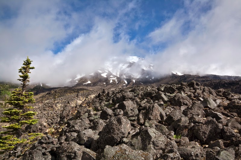
We all learned that Shel is apparently part mountain goat/part astronaut, sniffing out a route through lava rocks and vanishing trails. 

Shel leading the way through the lava fields on the Loowit trail

Woman on the moon :)

Sam learned that PB&Js do not survive being smooshed inside backpacks. They still, however, taste good. Shel introduced me to joys of box wine in the backcountry. And I learned that after a glass or two of Merlot, I apparently take lots of pictures of rocks and do poor imitations of the Karate Kid. 
 
It was still delicious

Karate Kid? Nope. (photo by Shel B.)

rocks

I’ve never backpacked around Helens before, and while I had heard water was scarce I wasn’t anticipating Swift Creek and Chocolate Falls to be bone dry this early in the season. The hunt for water in a pumice moonscape began in the late afternoon; we finally found that Swift Creek still existed about a mile up from the Loowit Trail, near the Worm Flows climbing route. 

sometimes you filter water where you can find it (photo by Shel B.)
 
Like most backpacking trips, the day falls into a few rhythms: enjoying (or not enjoying) the walk. 

Lava fields and "trail"

alligator skin tree

Sam passing through the gates of Mordor

following Swift Creek, hunting for water
 
Then there’s finding a suitable place to camp (sometimes this is more challenging than others). 


Sam, chillaxing (photo by Shel B.)
home sweet home


Afterwards, the world narrows down to food, water, shelter and doing, well, nothing. 


doing nothing

Helens from camp, clouds moving in

camp chores

serenely doing "nothing"

selfie simply for the sake of happiness


In the morning, you watch the world wake up over backcountry espresso. 


Backpacking frequently isn’t fun. It can be strenuous, stressful, and uncomfortable. But when it’s good, it’s really good. Neither Shel nor Sam were sure they would *like* backpacking, but they were interested in giving it a go. What struck them most (and the reason I seek it out) was the solitude, the silence of the evening. We were the only ones around. For the most part the weather held, bugs were minimal, and I tried to really consider a route that was good exercise with a good payoff that also wasn’t going to traumatize friends out for their first trip.


at 4000', we're in the clouds

heading home through the mist

Swift Creek

back through the lava

We done good. We done good. 

until next time, Helens

Lovely Ramona


rhodies mean it's June in the PNW

I won't say much about this lovely lady, simply because there are entire guidebooks filled with information about her. She's the Mona Lisa of Mount Hood- well photographed, well-documented, pilgrimages are made in her honor. It's been four years since I last visited Ramona; I usually do so in the shoulder season because although it really is a beautiful trail, it's filled with (for me) far too much company. Still, it's  the kind of  place you have to see at least once, and initiating new trail friends to Ramona's beauty is a must.

classic Ramona


Still working on getting the timing down on the jump shots though. {GRIN}. 

I love J.B.'s face in this one


the dogs are so confused...

Eureka!
 

RAMONA FALLS LOOP
Mount Hood Wilderness, Oregon
7.1 miles, 1000 feet elevation gain


Wilderness in a Day


TRAPPER CREEK-OBSERVATION PEAK LOOP
Trapper Creek Wilderness, Washington
~14 miles, ~3200 feet elevation gain

Monday morning saw me heading out for a much needed solo hike with the dog. Still on the hunt for new-to-me places, I decided on the Trapper Creek Wilderness located in southwest Washington. Like Indian Heaven, Trapper Creek lies in the Wind River area just north of the Washington side of the Columbia River Gorge… I have taken very little (if any time) to explore it.

Turned out to be a bit of a longer day than I expected.

The loop I picked consisted of following the Trapper Creek trail through the heart of the wilderness valley, committing to a steep climb up to Observation Peak before joining the extremely well-graded Howe Ridge trail back to the car. I chose this loop not only as recon for possible future backpacking trips, but also because it essentially explores the vast majority of Trapper Creek in one swoop: it’s a tiny, but significant wilderness, with only a little over 6000 acres, protecting beautiful old growth and spotted owl habitat. 

huge trees in the valley bottom
 

Although I had a map and a trail description, I just didn’t do something right on this trip. Still not sure what, but it’s been a looooong while since I’ve been creeped out on day hike; something about this loop spooked me. Maybe my Spidey senses were hollering at me. Maybe it was over exertion and fatigue (I just was not feeling my Wheaties on this particular day). Maybe it was that my trail description and the speed at which I usually hike did not match up at all, which created some concern that I was lost (I wasn’t), took a wrong turn (I didn’t), or that I bit off much more mileage than my feet could chew given daylight constraints (verdict is still out on this one but I did manage to haul the six miles back to the car from Observation in about two hours). It may have also had something to do with the “primitive and challenging” trail conditions that are maintained only by a Portland mountaineering club, the Mazamas. In retrospect, nothing was ever all that bad, it was just a combination of all the factors that led to me feeling like I wasn’t where I was supposed to be. Such is the nature of hiking. 

crossing Trapper Creek, the climb begins

I felt very small next to this fellow


no shit, Sherlock

little green details on the Howe Ridge trail

 
All told, it took me about seven hours to complete this very, very lovely loop. I traversed deep valleys filled with roaring creeks and the silence of giant trees. I sweated and cursed my way up the single-track, primitive climb out of Trapper Creek to Observation Point, emerging onto a quiet, empty high ridge that clearly sees little foot traffic. I cruised through magnificent, sun-dappled old growth, bird song and wind the only sounds. And I got my wish for solitude as I encountered not a single soul all day.